日志
鸦片战争之前的古代中国地图
热度 15 |
2020-7-7
1、宋代绘制的《禹贡九州山川之图》:

2、明代根据古山海经绘制的《中国十三省图》和《九州图》:

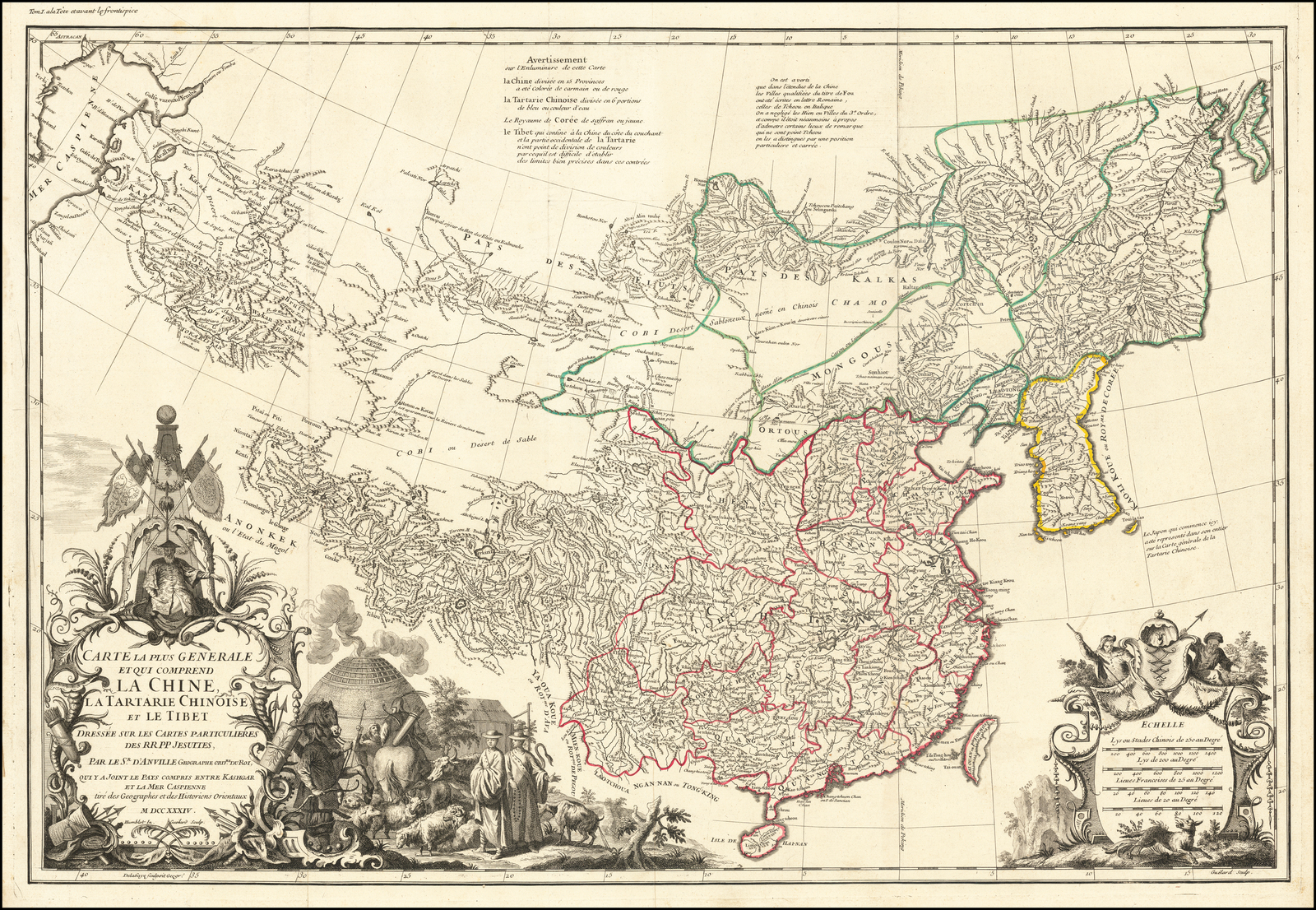
3、1720年大清康熙年间绘制《皇舆全览图》的西文版:The Qing Emperor Kangxi commissioned a ground of Jesuit surveyors to chart his kingdom from 1708 to 1716. The resulting maps were published as the Kangxi Atlas (1718-19), and the information contained on its woodcut maps would not be superseded for well over a century.

- The leading French cartographer Jean-Baptiste Bourguignon D'Anville (1697-1782), acquired copies of the Kangxi maps and devised his own interpretations, first printed in Jean-Baptiste Du Halde's Description Geographique … de la Chine (Paris, 1735):
4、德国制图家约翰·马蒂亚斯·哈斯(Johann Matthaus Haas)于1740年绘制的《 REGNI SINAE vel SINAE PROPRIAE Mappa et Descriptio Geographica》,是在法国制图家唐维尔(Jean-Baptiste Bourguignon D'Anville)1735年绘中国地图的基础上完成的,也是后来默娘送给习大的礼物。
5、其实,德国后来(1838年)绘制的一幅中国地图更加详细,不过在这张地图中,中国是和日本放在一起的,朝鲜和蒙古都在中国版图之内,送起来当礼物,可能会引起不必要的外交纠纷:


全部作者的其他最新日志
- • 西方爱情诗选 之 我思故我爱
- • 从文自传 之 湘西儒将
- • 千年世家 之 神仙打架
- • 从文自传 之 杀人
- • 灯下漫笔 之 河南匪气
- • 租界里的杂文 之 募捐
